Pencil Tracks and Vanished Channels: Navigating by Old Admiralty Charts

An old Admiralty chart is a curious thing. Spread it on the cabin table and it looks like a nautical antique: thick paper, soft creases, maybe a coffee ring from a previous owner. But take a pencil, a pair of dividers and a mug of tea, and the sheet starts to talk. In 2026, with plotters glowing and tablets humming, there is still a place for the paper ghosts.
The chart as a companion, not a commander
Let us be clear from the start. The current chart, whether paper or electronic, is the authority. Old charts are a companion, a source of context and a prompt for careful thought. They are not a licence to cut a corner because a 1912 engraver left a tempting gap in the drying line.
The pleasure lies in what they add. A modern chart tells you where the water is now, or at least where the surveyor found it recently. An old chart tells you where the water used to be, where the buoys once sat, and what earlier sailors thought worth noting in the margin. Used properly, that is not nostalgia for its own sake. It is another pair of eyes.
Reading the ghost geography
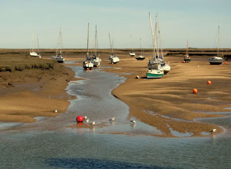
Start with the broad shapes. Estuaries shift. Channels migrate. Sandbanks grow a shoulder and then lose it. On old charts of the Thames Estuary, the Essex swatchways and the approaches to the Humber, you can often see channels that have since silted or moved, their outlines drawn with the confident hachures of a different era.
That matters for a classic boat because our drafts are often modest and our speeds are often gentle. Knowing that a shallow patch was once a working channel does not mean you should charge across it, but it does explain why a particular line of marks exists, why a harbour wall points the way it does, or why a local pilot has a habit of peering over the side at a certain state of tide.
Look, too, for abandoned leading marks and transits. A faint pair of lines across a bay may once have kept a coaster clear of a shoal. The marks themselves may have gone, but the geometry can still tell you something about the shape of the seabed and the way the water sets. Compare it with the current chart and the story sharpens.
The margins are the memoir
The real treasure is often in the margins. A pencil note reading “best on a spring flood”, a small cross where a buoy once swung, a line of dots showing a previous owner's track through a tricky entrance: these are the fingerprints of people who went there before you. They are not gospel, but they are conversation.
I have a soft spot for charts annotated by yachtsmen rather than professionals. The surveyors and engravers gave us the bones; the amateur navigators added the flesh. A neat hand may record a changed light characteristic, a useful back bearing, or the fact that the harbourmaster's dinghy likes a cup of tea. That last one is not hydrography, but it is pilotage of a sort.
Treat such notes with respect and suspicion in equal measure. A 1960s pencil track may have been made by a boat with a different draft, in different weather, on a different tide. It is a hint, not a route.
Pair old and new without tears
Comparing an old chart with a current one is a good discipline. Lay them side by side, or use a chart app for the modern version if cabin space is tight. Check the scale first. A small-scale passage chart and a large-scale harbour plan will not line up neatly, and forcing them to do so is a recipe for confusion.
Then check the datum. Chart datum and the drying heights printed on old sheets may not match the current edition, and magnetic variation has moved on. Buoyage has changed, too: what was a red can in 1950 may now be a different shape, colour or position altogether. None of this makes the old chart useless. It simply means you read it with the modern sheet in the other hand.
A sensible routine is to use the old chart for questions, not answers. Why does the current chart show a swatchway here rather than there? Why is that leading mark set at that angle? Why does the pilot book mention a shelf that no longer appears? The old sheet often supplies the reason.
A few cockpit habits
Keep the old chart flat and dry, or as dry as a small boat allows. Pencil, not ink, is the right tool for your own notes. Date them. A note saying “3m at HW springs, 14 May 2026, moderate swell” is worth ten vague arrows. If you photograph the chart for a tablet, photograph the margins as well as the middle.
And do not be shy of writing on it. A chart that has been used is a chart that has earned its place. The next owner may curse your handwriting, but they will also learn something.
Where the paper ghosts live
Old Admiralty charts turn up in chandlers, second-hand bookshops, estate sales and the quieter corners of harbour museums. Some are tatty, some are beautiful, and a few are still perfectly usable as planning aids. Buy the ones that show water you actually sail, not just the ones with pretty compass roses.
In the end, the value is not in pretending the past is the present. It is in letting the past ask better questions of the present. A classic boat already carries a little history in her planking. An old chart in the chart table is simply another voice from the same conversation: quiet, pencilled, and often surprisingly wise.